There has been little change since my last update last night with Dorian in regards to it’s “current” strength and motion. There are some changes in regards to its future intensity and potential track. I will go into more detail below.
As of 5pm on Aug 29th the storm was still moving NW at 13 mph with maximum sustained winds at 85 mph. Nothing has changed since my last blog in regards to intensity and motion.
The biggest change is that the NHC is now predicting a Major Cat 4 Hurricane, which means max sustained winds of over 130 mph hitting Florida. Strengthening is expected to occur once the storm nears the North Western Bahamas sometime Sunday afternoon. All the ingredients are there for growth, very warm waters, low wind shear, and moist air aloft. The dry air that was inhibiting Dorians growth has moved away. The area is PRIME for development and will it will provide fuel for Dorian.
Another change is the forward speed of Dorian going forward. Dorian is now predicted to make landfall in Florida on Monday afternoon instead of Sunday as originally thought. The storm will be slowing down due to the stearing currents aloft or lack thereof.
I am more concerned about the forward speed and the ramifications of Dorian slowing down. The storm may “possibly” linger in the Central Florida area for 24-36 hrs dropping copious amounts of rain. Major flooding can be expected if this occurs.
I keep seeing all the memes on Social Media making light that no one really knows where this storm is going. This is correct, it can make landfall just about anywhere along the Florida East Coast up to Georgia. This is the main reason to keep paying attention to the forecast, this Blog or whatever source you rely on.
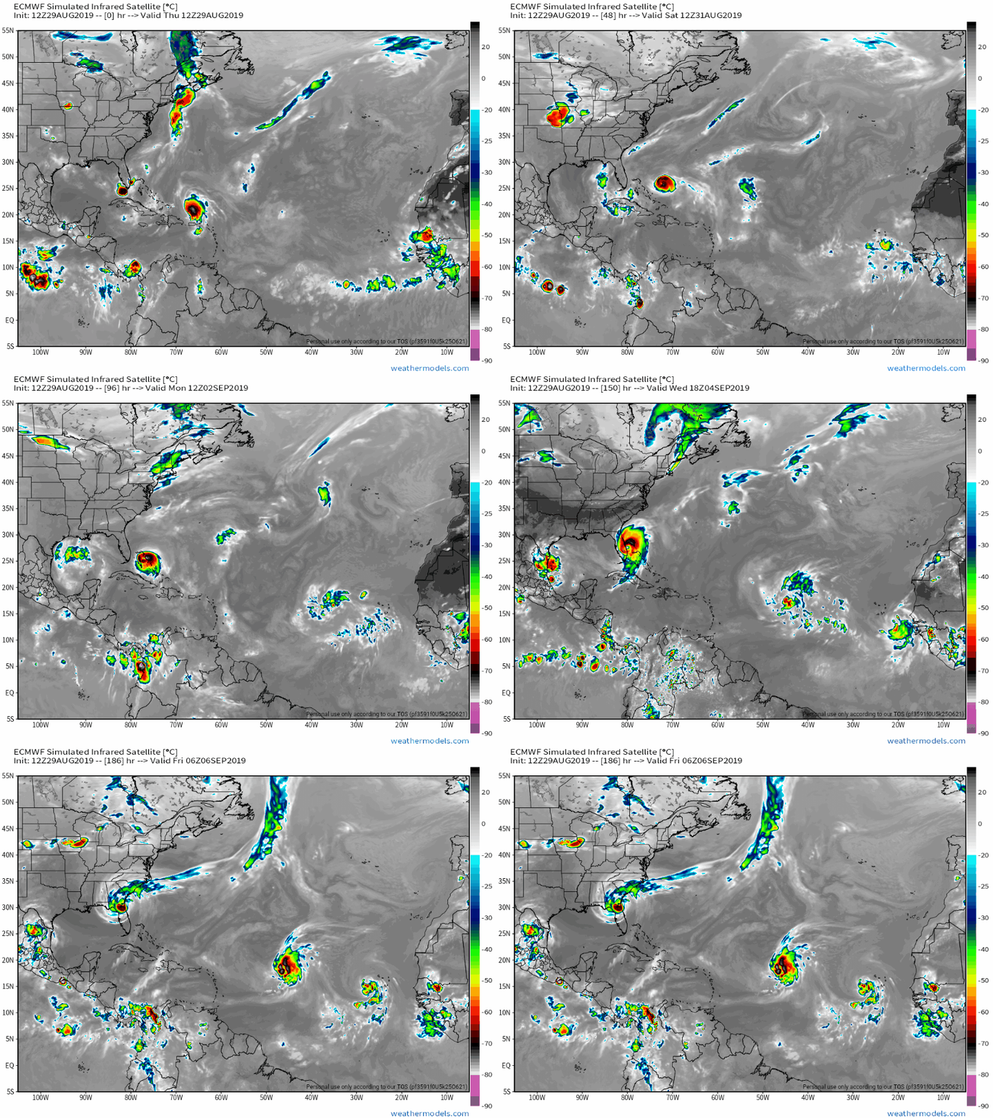
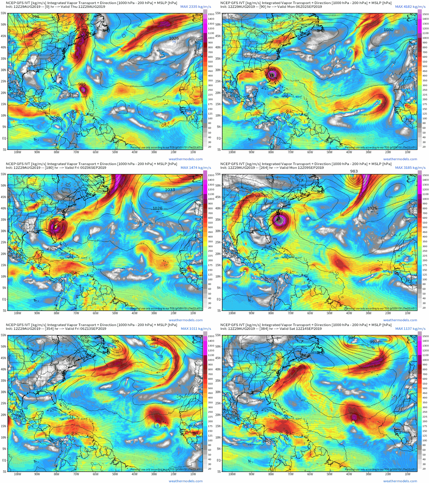
Right now the European model has it going slower and going further South, over Dade and Broward counties. The other reliable model GFS has it further North making landfall around Palm Beach, Vero Beach area and moving much faster.
I can say with confidence that we wll be impacted in Florida one way or another. Best case Tropical Strorm gusts and obviously worst case experiencing a Major Hurricane.
The key as I’ve been saying is the high pressure ridge and how far West it digs. The latest models have it going West over Florida and then retreating slightly East right after land fall.
What does this mean? The storm possibly making landfall in anywhere in SE Florida up to Melbourne area and then sitting and hanging out for a day or so in Central Florida before riding up the coast to Ga, SC and NC. This is a real possibility at this time. Flooding will be a major problem if this occurs.
Again, this is very fluid and Dorian has had a mind of it’s own and hard to forecast.
Please, please don’t focus on the center of the cone and that it’s only a Cat 1 storm ccurrently. This hurricane is small, but it will intensify and grow from its current state. It is currently going through an eye wall replacement which means it will intensify. This storm isn’t as large as Irma was in 2017 which is a good thing as the strong winds will be very con


centrated near the center, but Dorian will grow from it’s current state, this will happen.
I think that by tomorrow night, Friday Aug 30th we will have a lot better idea of where Dorian is headed. Until then, stay tuned, and prepare just in case!
Go buy your supplies, water, snacks, batteries, and has up your cars. Worst case you can always eat all those chips and snacks you purchased for the storm over the next few weeks since football season is upon us!!
Please see latest European and GFS model runs below.
Stay safe and I will post updates tomoreos afternoon.
OG