There has been a lot of shifting of the models from North to South and now North again over the past 24 hrs.
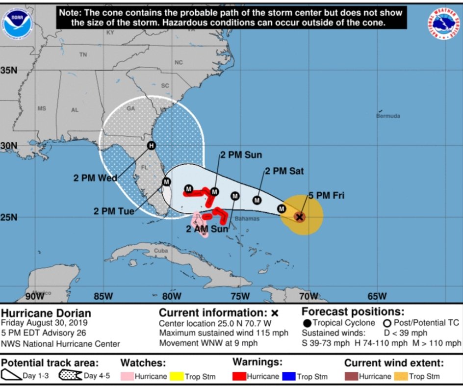
Dorian is currently moving WNW at only 9 mph with max sustained winds of 115 mph, which is a Cat 3.
The latest European model and American GFS model have both been trending North most of the day today which is great news for Dade, and Broward counties, not so much for Palm Beach and points North. However this can and will probably change a few times prior to land fall.
What’s causing the changes in the projected track? The speed of the storm is actually helping South Florida at ” this point in time”.
By the storm slowing down it is allowing the High Pressure ridge I’ve been talking about all week to move West towards Florida and then retreat a bit to the East. There will be a window where the stearing currents aloft will be weak. This will allow the upper level winds that blow from West to East accross the US to “possibly” catch Dorian and move it North, and then North East where the High pressure will leave a gap. Think of a “tunnel” in the atmosphere and the storm taking that tunnel and following its path.
I have been pretty consistent in predicting a Palm Beach, North Palm beach landfall and then having Dorian heading North, North East after land fall. I am not 100% confident but I feel this is the most likely scenario. This is only my opinion that is based by me reviewing many model runs and current atmospheric conditions, and not etched in stone by any means.
As of now the models are showing landfall around Palm Beach as well, along the Jupiter area and then hugging the coast all the way up to Jacksonville.
The main problem with this forecast is that the storm will still be able to tap into the warm waters of the Atlantic being so close to the shore. Another issue is the SLOW movement of Dorian and the amount of rain it will drop in its path.
The latest NHC timeline has Dorian making landfall around 2pm on Tuesday as a Cat 3 or 4 and it will still be in Florida between Central Florida and Jacksonville on Weds at 2pm as a Cat 2. This is little movement in 24 hrs and not much decrease in intensity. This could be catastrophic for this part of Florida, a tremendous amount of rain can fall in this area and major flooding can be expected.
I still expect Tropical Storm force winds for all of South Florida with higher gusts unless we get really lucky and Dorian stays off shore right before arriving in Florida.
This storm is relatively small in size “Diameter” which helps. As of now Hurricane force sustained winds extend out between 25-30 miless from its center. Take where you live and go North 25-30 miles if you are in SE Florida and mark that point. That point is where Dorian’s center would have to pass in order for your home to get sustained Hurricane force winds. The same thing with Tropical Storm force winds, except these extend out 100 miles. Most of us will have TS force winds using this formula regardless.
I would remind you that basically ALL of Florida is still in the cone and things can and will probably change again. We can’t let our guard down and just think that now that the models are trending North that we are out of the woods, we are not! We need to continue to prepare and plan as if we are going to have a direct hit by Dorian and hope that we don’t.
I will update again tomorrow and lets hope the Northern trends continue.
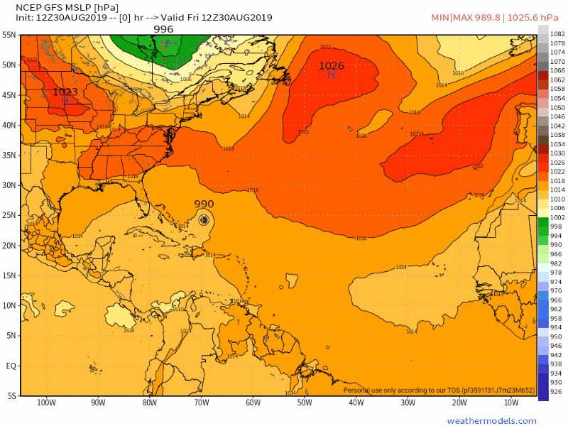
Below is the latest NHC cone, and European and GFS models
OG